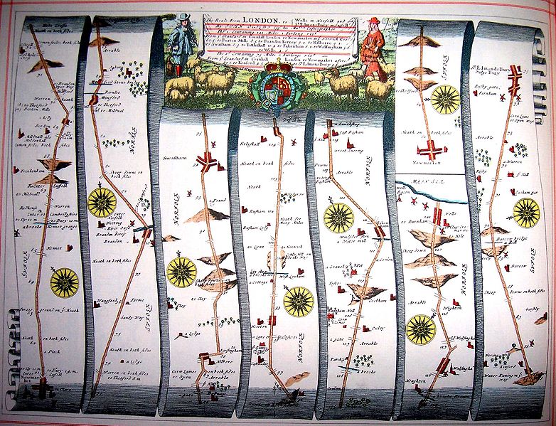
English mapmaker John Ogilby completed a startling project in 1675: a road atlas of 17th-century Britain, offering strip maps of most of the major routes in England and Wales. He wrote to Charles II:
I have Attempted to Improve Our Commerce and Correspondency at Home, by Registring and Illustrating Your Majesty’s High-Ways, Directly and Transversely, as from Shoare to Shoare, so to the Prescrib’d Limts of the Circumambient Ocean, from the Great Emporium and Prime Center of the Kingdom, Your Royal Metropolis.
It used a consistent scale of one inch per mile, with each mile comprising 1760 yards, a standard that later mapmakers would follow. You can see the whole atlas here.