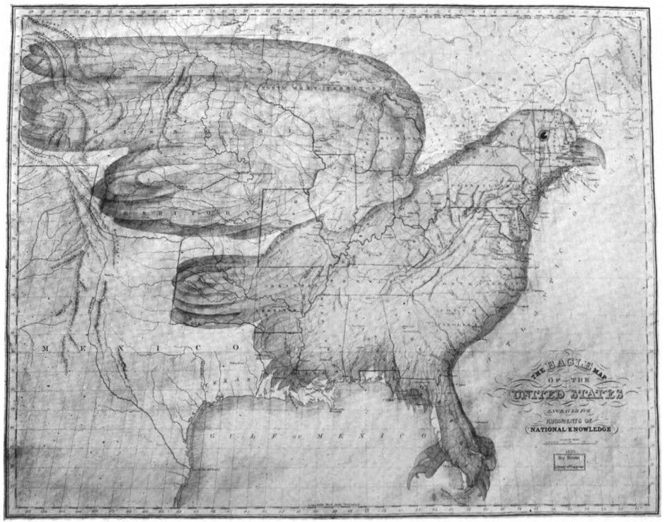
A truly ‘spread eagle map’ is found in a small book of 1833, entitled, ‘Rudiments of Knowledge,’ by Joseph Churchman. This eagle map is explained very geographically. The United States and territories are represented under the figure of an eagle; the States of New Hampshire, Vermont, Massachusetts, Rhode Island, Connecticut, and a part of New York being chiefly included in the head and beak — the remainder of New York, New Jersey, and Pennsylvania, principally embraced in the neck — the outline of coast, from Cape Henlopen to South Carolina inclusive, making the turn and formation of the breast, Florida representing the legs — the Arkansas territory, including the land occupied by the Cherokees to the Spanish line, forming the tail — the northern line of the United States, through lakes Ontario and Erie to Detroit, describing the back — the wings raised and the outline of them curving with the line of the United States through lakes St. Clair, Huron and Superior, and spread and extended to overshadow a large part of the Missouri territory.
— P. Lee Phillips, “Some Peculiar Maps,” Daughters of the American Revolution Magazine, August 1918