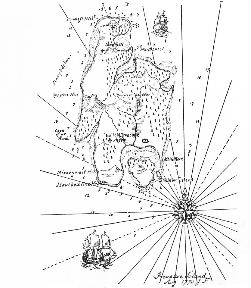
Robert Louis Stevenson’s original map of Treasure Island was lost during publication. He sent it to his editor and was “aghast” to learn that it was never received. “I had written it up to the map,” he wrote — most of the novel’s plot had been inspired by the picturesque map he had dreamed up at the start. Now he had to redraw it working backward, inferring the island’s layout from the descriptions in the text.
It is one thing to draw a map at random, set a scale in one corner of it at a venture, and write up a story to the measurements. It is quite another to have to examine a whole book, make an inventory of all the allusions contained in it, and with a pair of compasses, painfully design a map to suit the data. I did it; and the map was drawn again in my father’s office, with embellishments of blowing whales and sailing ships, and my father himself brought into service a knack he had of various writing, and elaborately FORGED the signature of Captain Flint, and the sailing directions of Billy Bones. But somehow it was never Treasure Island to me.
“It is, perhaps, not often that a map figures so largely in a tale, yet it is always important,” Stevenson wrote. “Even with imaginary places, [the author] will do well in the beginning to provide a map; as he studies it, relations will appear that he had not thought upon; he will discover obvious, though unsuspected, short-cuts and footprints for his messengers; and even when a map is not all the plot, as it was in Treasure Island, it will be found to be a mine of suggestion.”
(From Stevenson’s “My First Book: ‘Treasure Island,'” first published in the Idler, August 1894.)